
6M km2
6m km2 is a project for the deployment of sensors aimed at measuring environmental variables of the oceanic aquatic mass that covers the surface of our continental plate.
6 million square kilometres is the surface of the Argentine Continental Shelf, in its entire geological breadth.
The objective is to ensure the protection of the environment, contribute to goal 14 of sustainable development of the United Nations and promote the strategic valorization of the Argentine sea as the last frontier of natural resources for development.
Gliders for environmental measurements
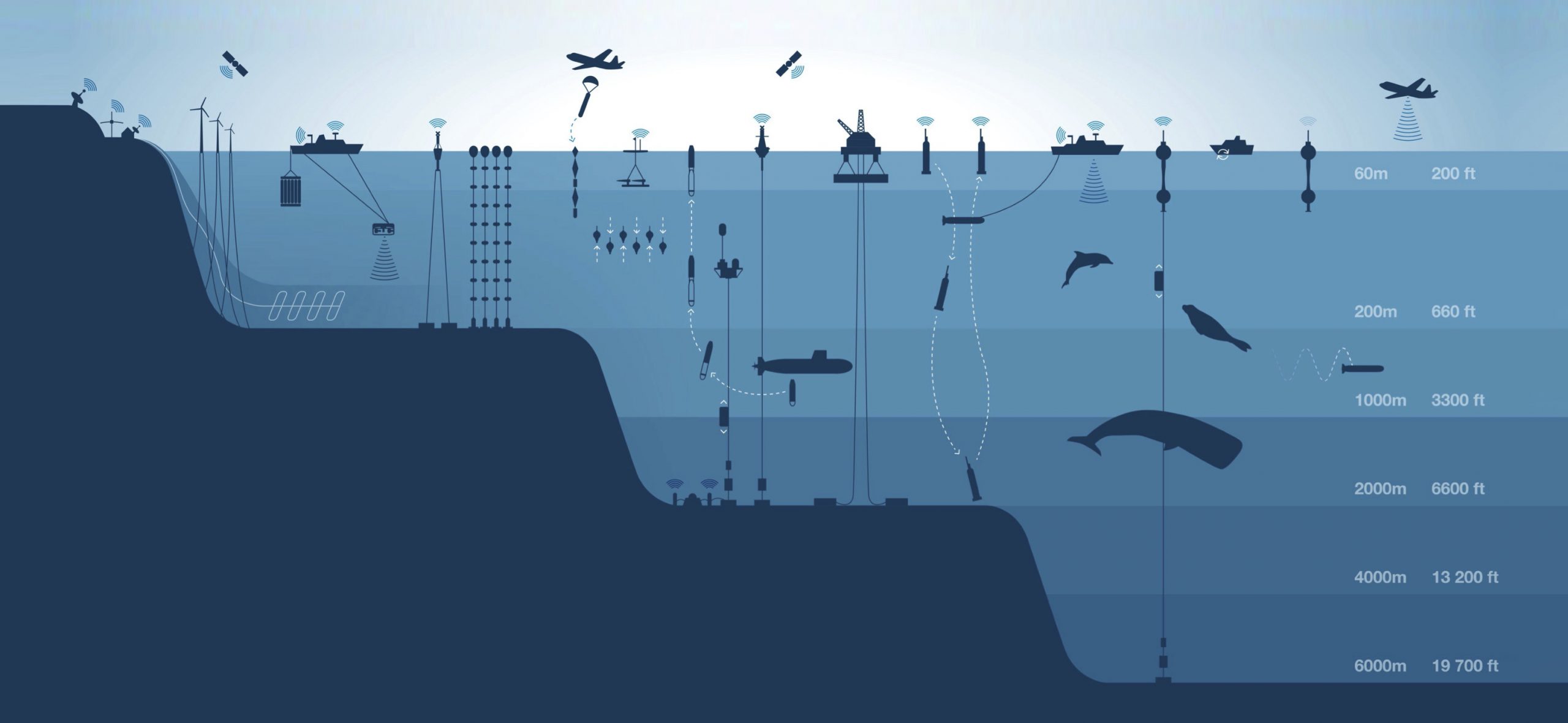
Gliders are measuring instruments whose itinerary can be programmed and modified remotely. They have an energy autonomy of 9 months. Data can be integrated in real time.
At an international level, the information provided by gliders is integrated into an ocean observation system that provides real-time data for use in climate, oceanographic research, geology and biodiversity.
Currently, Argentina contributes with only 1 sensor.
Data and uses of the information generated
The data and information generated by gliders has various uses for environmental protection, such as sea level data, ice melting, species migrations, and tectonic movements. It also provides very useful information for the economic use of sectors such as logistics, hydrocarbons, mining and fishing.
Data
Economic uses
Environmental uses
Big data oceánica
Nuevas fronteras ambientales
Nuevas fronteras de recursos naturales
